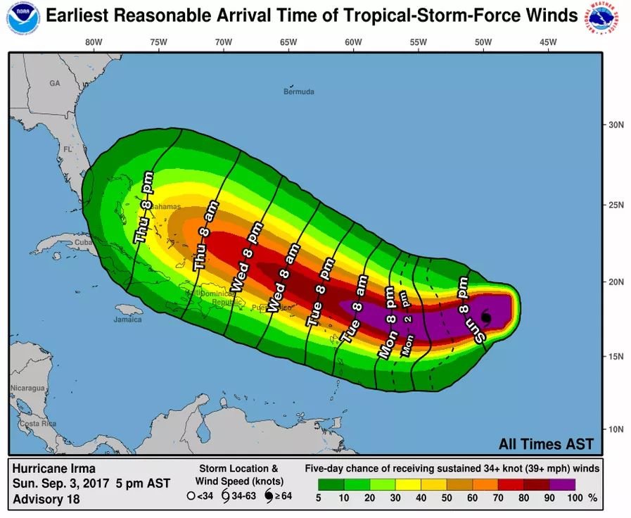
Photo Caption: Hurricane Forecast Track Map
Published: Sunday 3rd September, 2017
By: T. Chapman
SKN PULSE – With immediate effect a Hurricane Watch is in place for the Leeward Islands and other surrounding Islands. The islands under immediate watch are Antigua, Barbuda, Anguilla, Montserrat, St. Kitts, Nevis, Saba, St. Eustatius, Sint Maarten and Saint Barthelemy.
As of 5 p.m. AST/EDT, Hurricane Irma was centered over the central tropical Atlantic Ocean about 790 miles (1275 km) east of the Leeward Islands, moving toward the west near 14 mph (22 km/h). According to the Hurricane Center report, a westward to west-southwestward motion with some reduction in forward speed is expected throughout Monday night.
The center of Irma is expected to approach the northern Leeward Islands late Tuesday with Maximum sustained winds near 115 mph (185 km/h). Presently, Irma is forecast to be a category 3 hurricane. Some strengthening during the next 48 hours is expected. A NOAA Hurricane Hunter aircraft is en route to investigate Irma.
Hurricane conditions are possible within the watch area by Tuesday night with tropical storm conditions possible by late Tuesday.
The general public in the Leeward Islands, the British and U.S. Virgin Islands, and Puerto Rico should continue to monitor the progress of Irma and take necessary precautions.
Additional hurricane and tropical storm watches may be required for portions of this area on Monday.
Note that the National Hurricane Center – www.hurricanes.gov – will issue an intermediate advisory at 8 p.m. AST/EDT and the next complete advisory at 11 p.m. AST/EDT


